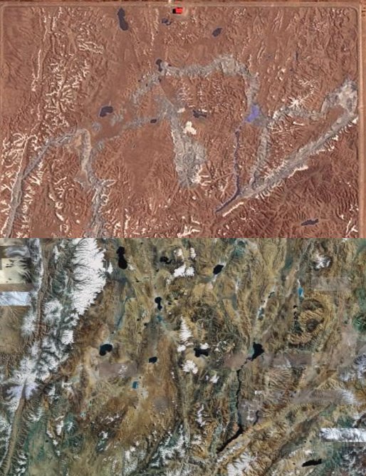
Knowing your terrain... literally
Well I first heard about this from by dearly beloved TWiT podcast, and what a story it is. If you want to read about it yourself here is the link to The Register where the story was published. The story is about a few people who were exploring with the Google Earth product, and they discovered a piece of land in China that looked like a scale model of a mountainous landscape. Actually it was a scale model of an area between the Indian/Chinese border, that apparently has disputed ownership.
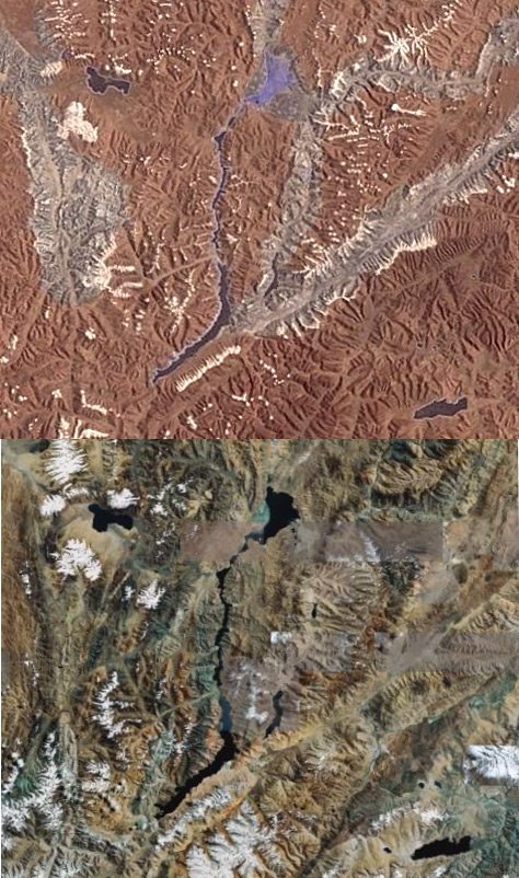
Here is a closer look.
Well I'm guessing the Chinese Air Force and Army would be better prepared to fight in the area, if the need arises. Well it's just surprising what technology can find these days, and I'm thinking the Indian's are surprised. But don't start a war now, because apparently the Chinese know the terrain better than you...
posted by Tabish Talib @ 8:07 PM
2 comments
![]()


2 Comments:
Those crafty Asians....
-Kyle, lol
Very interesting. Reminds me of those places the Russians had in Novogrod at the end of The Boure Ultimatum, replicas of fully functioning, whole American and European towns.
Post a Comment
<< Home